A large winter storm will cover the eastern United States with rain, lake-effect snow, and cold temperatures from Tuesday, December 10, to Thursday, December 12. The same low-pressure system that is causing thunderstorms and tornado warnings in the South on Tuesday will form into a wide-ranging storm as it moves northeast on Tuesday night into Wednesday. Meanwhile, an Arctic blast will bring freezing temperatures centered in the Midwest, with some areas potentially falling below -20 degrees Fahrenheit. Here’s the forecast for the upcoming winter storm throughout the US.
What is the weather forecast for the coming winter storm?
The winter storm is forecast to drop anywhere from 1 to 4 inches of rain and snow over the next three days to Friday, with larger totals possible up to 8 inches near higher elevations and the Great Lakes.
As reported by The Weather Channel, most of the rain and snow from the storm will fall Tuesday and Wednesday, causing potential flash flooding and several severe thunderstorms. While this is not as severe as the earlier winter storm this December or on Thanksgiving, the highest risk of localized flooding will be from Long Island to New England due to saturated soil from the rain combined with melting snow.
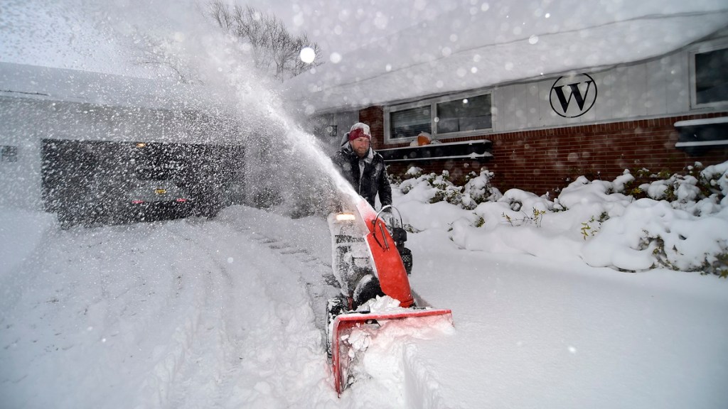
Much of the precipitation is expected to end by Thursday night, but the areas around the Great Lakes, such as Buffalo, New York, could add up to a foot of snow from Wednesday to Friday.

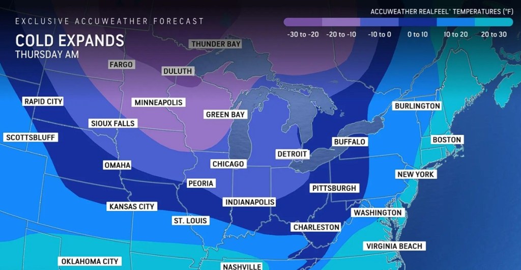
At the same time, air pulled from the Arctic will bring subzero temperatures throughout the Midwest and the Northeast, per AccuWeather. The greatest freeze will occur between Wednesday night and Thursday morning, as Minnesota, Wisconsin, North Dakota, and Michigan could reach wind chill temperatures from -10 to -30 degrees Fahrenheit. Much of the other states in the Midwest and Northeastern US are expected to feel a sting as well with highs in the single digits and low teens.
The spread of these severely cold temperatures is partly due to powerful wind gusts ranging from 50 to 70 mph, bringing the Arctic air through the central Appalachians and toward the Atlantic Seaboard. In addition to flash flooding, there’s also a risk for potential localized power outages along the eastern US coast on Wednesday.


