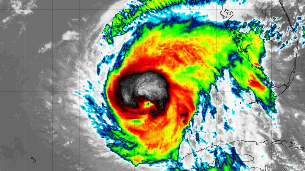
Tracking Hurricane Rafael has been tough over the past week, especially after yesterday’s models that have the storm going on an unpredictable path in the Gulf of Mexico. But various trackers for the hurricane on Thursday, November 7, have narrowed the field down as it moves toward the center of the Gulf after crossing Cuba as a Category 2 hurricane. Here’s the latest update for where Hurricane Rafael is expected to go as we head to the weekend.
Where is Hurricane Rafael going in the Gulf?
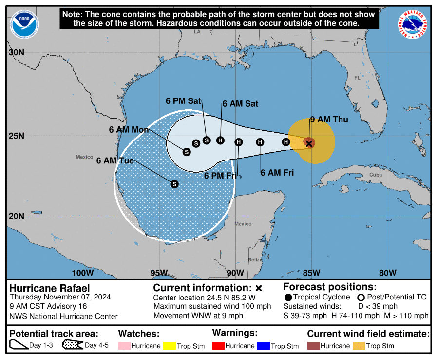
The most likely path for Hurricane Rafael has it moving west across the Gulf, missing the United States altogether, and spinning south toward the Bay of Campeche in the next five days.

The National Hurricane Center (NHC) has updated its projections in a report on Thursday at 9 AM CST. It predicts that Hurricane Rafael will move relatively slowly west, reducing in strength to a tropical storm by 6 PM Saturday. It will then likely turn south and dissipate as it heads toward Mexico by Tuesday next week.
Accuweather has also changed the eye path for the hurricane, which it stated yesterday was on track to move across Louisiana. Now the weather service largely concurs with the NHC’s projections, adding that the storm will likely move toward a wall of drier air along the coast of Mexico and “increasing wind shear” that will weaken its strength considerably. For Thursday, though, the Florida Keys might experience a minor storm surge of 1 to 3 feet as the storm passes by.

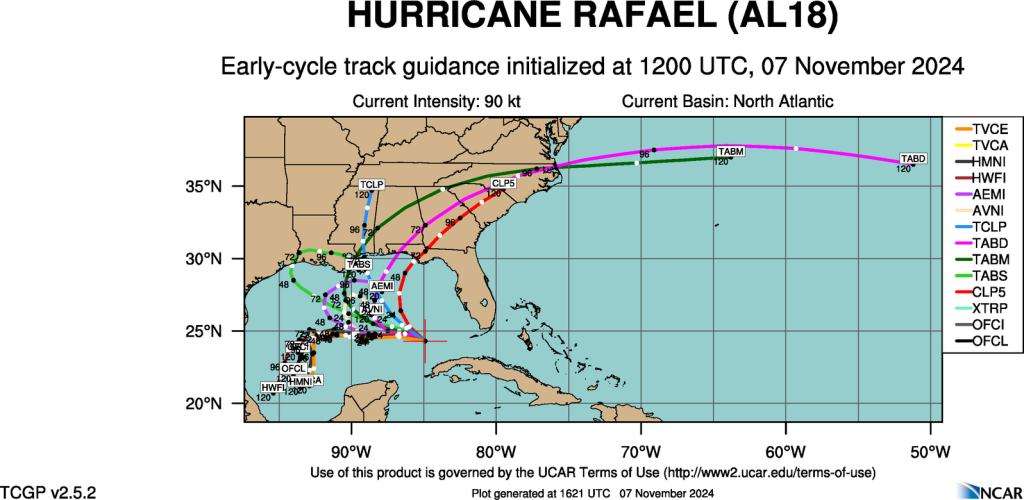
As for the National Center for Atmospheric Research (NCAR), the spaghetti models for November 7 at 4:00 AM PT still have a wide spread of possible paths for Hurricane Rafael that runs from Mexico to the panhandle region of Florida. But the vast majority of models in its track guidance still agree with the NHC and Accuweather’s Thursday projections.
Meteorologist Brian Shields, known on YouTube as Mr. Weatherman, also believes that the most likely path of the hurricane will curl southward. While the American model (GFS) has the storm moving north toward Louisiana, he has leaned into the European model instead as that has been a better tracker for the hurricane thus far.


