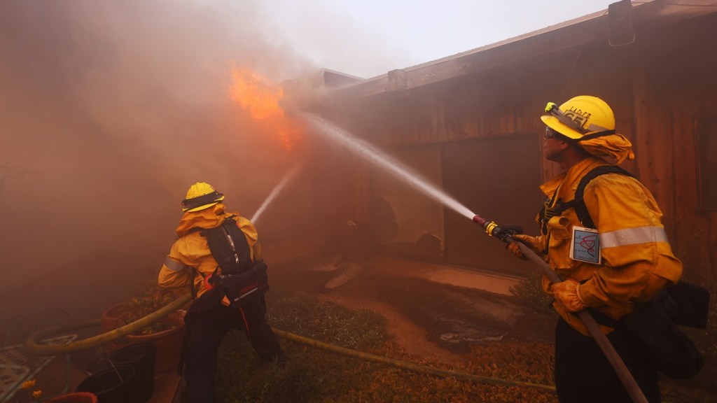
The Hurst fire map in the Sylmar area reveals yet another major wildfire impacting Los Angeles, alongside the Palisades fire, Eaton fire, and Woodley fire. The blaze was first reported by Cal Fire on Tuesday, January 7, at 10:37 PM PT at 100 acres, and it quickly spread to 500 acres in just three hours by January 8 at 1:47 AM PT, impacting areas near San Fernando, Newhall, and O’Melvany Park. While much of the focus has been placed on the larger Palisades and Eaton fires, this Sylmar fire has divided the attention of firefighters who are struggling with low resources and rough fire conditions throughout LA County.
What is the Hurst fire map now in Sylmar?
The Hurst fire map, or Sylmar fire map, shows that 505 acres have burned so far and that it remains at 0% containment, as of January 8 at 10:32 AM PT.

Mandatory evacuation zones (in red) and evacuation warnings (in yellow) have been issued throughout the affected area. This has impacted over 3,000 residents throughout the Sylmar neighborhood in San Fernando Valley.
As reported by CNN, the combination of the Hurst Fire and the Palisades fire were “stretching the capacity of emergency services to their maximum limits,” according to city Fire Chief Kristin Crowley on Wednesday morning.
Abnormally high wind gusts have been reported throughout the Los Angeles area, with the Hurst Fire area receiving gusts near 72 mph in the Saugus neighborhood of Santa Clarita. A status update issued by Cal Fire at 10:32 am on Wednesday notes that the blaze is “spreading rapidly under high winds” and that “dry fuels, strong winds, and low humidity is contributing to aggressive fire behavior.”
A report by FOX 11 Los Angeles says that some residents in the area received alerts on their phones, but others did not and were notified of the fire by neighbors. The Hurst fire forced the closure of northbound and southbound connectors to Interstate 5.
Fortunately, firefighters have been quick to respond to the situation, and the blaze has not expanded over 505 acres since 1:47 AM PT on Wednesday according to official status reports from Cal Fire.


