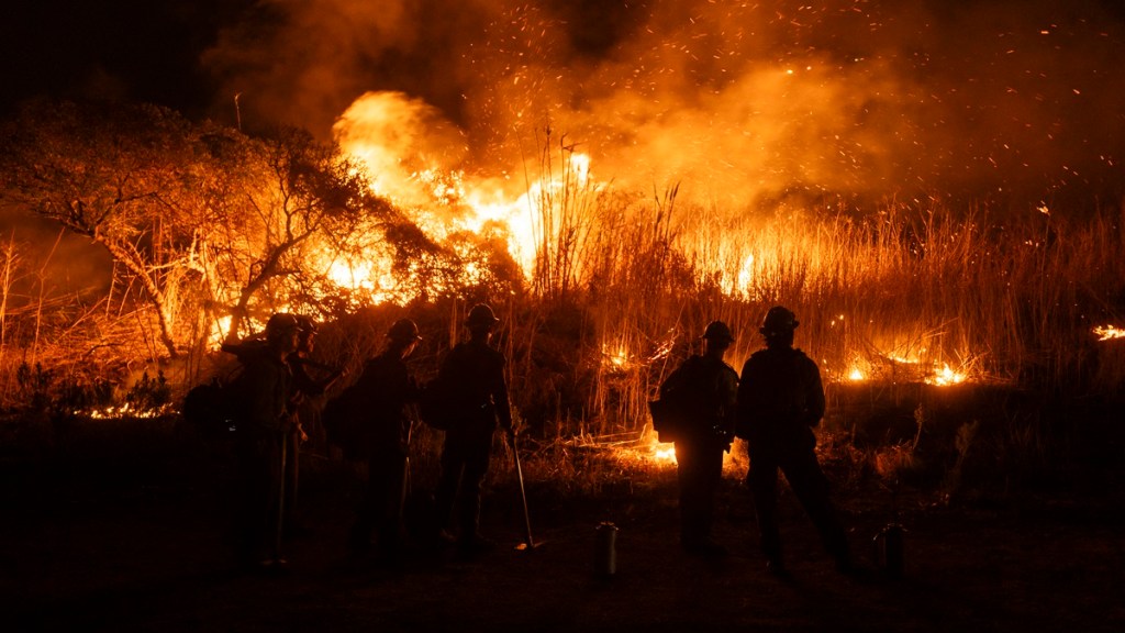
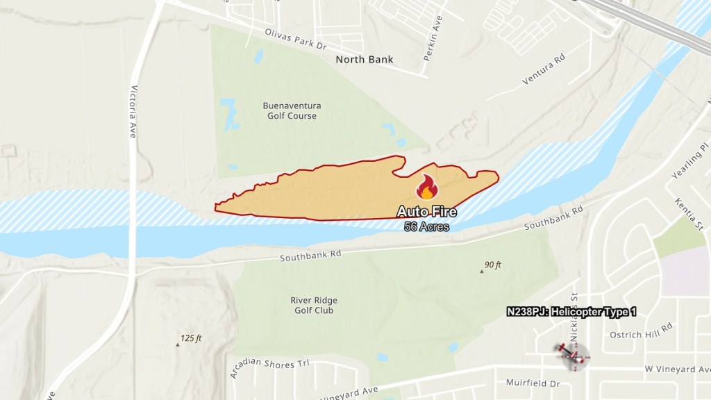
The Auto fire map in Ventura and Oxnard reveals the latest update of the wildfire. As reported by Cal Fire, the blaze started on Monday, January 13, at 9:25 PM PT and quickly scorched 56 acres within two hours. Evacuations were ordered for the immediate area as firefighters attempted to halt its progress as the fire spread at the edge of the Santa Clara River between the Buenaventura Golf Course and River Ridge Golf Club. Here’s what we know so far about the containment of the Auto fire in Ventura County.
What is the containment of the Auto fire?
The Auto fire is still at 0% containment, according to the incident update on Tuesday, January 14, at 8:26 AM PT. The good news is that firefighters have managed to stop the forward progress of the wildfire.
As noted by CNN, firefighting teams from the Ventura County Fire Department, Oxnard Fire Department, Ventura City Fire Department, and a naval base close by the area prevented the spread of the blaze.
While the Auto fire is under control, the threat of it expanding still looms. On Monday, the National Weather Service in Los Angeles and Oxnard placed a red flag warning for the area from Tuesday, 4 AM PT, to Wednesday due to high winds and low humidities. This is why crews and many pieces of equipment still remain at the scene, as reported by the Ventura County Star, as Santa Ana winds continue to pelt the region.
No cause for the Auto fire has been determined yet and it remains under investigation. Fortunately, no structures were threatened by the wildfire.
The swift response to the fire is good news for firefighters still battling the larger Palisades and Eaton fires. As of 10:00 AM PT on Tuesday, the Palisades fire has spread to 23,713 acres and has only 17% containment while the Eaton fire has burned 14,117 acres and has only 35% containment.


