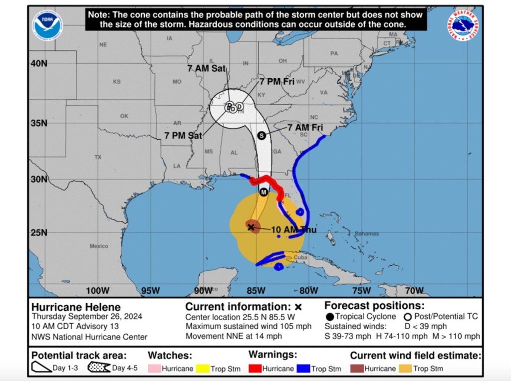
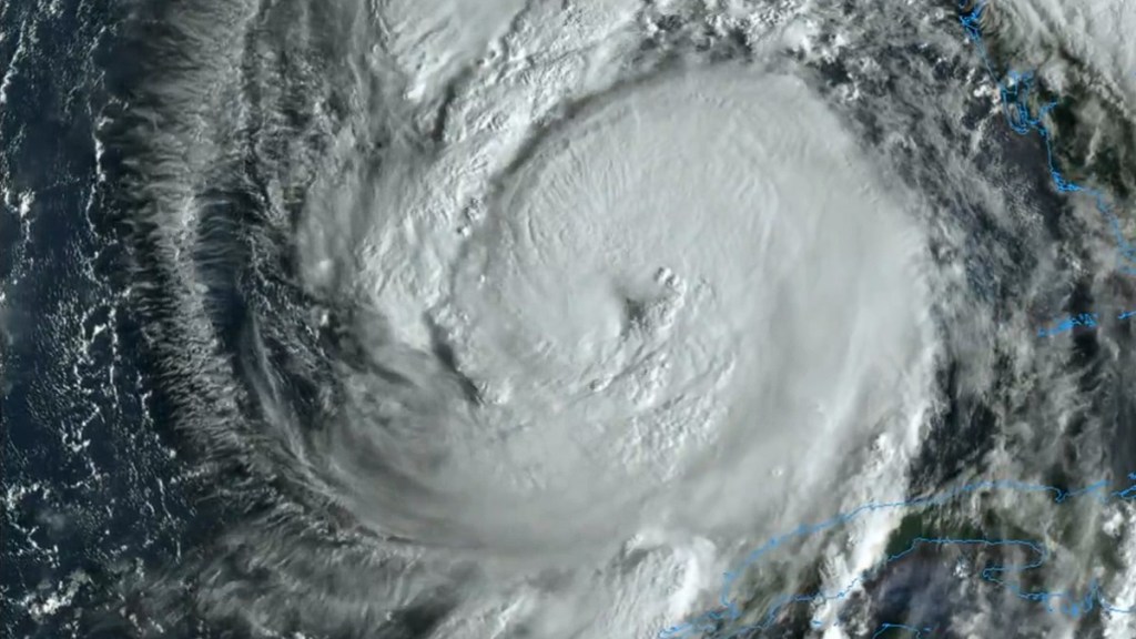
Residents in the southeastern US are concerned about the Hurricane Helene timeline and where the storm is going. Current projections have the heart of the system heading through Florida and Georgia over the next several days. As of an advisory on Thursday, September 26, Hurricane Helene has been declared a Category 2 and is projected to intensify into a Category 3 by the time it makes landfall along the Gulf Coast of Florida. The main concern of Helene is the potential storm surge, especially around the Big Bend coastline, which might see the water level rise anywhere from 12 to 20 feet.
Hurricane Helene timeline, path, and projectory through to the weekend
The timeline for Hurricane Helene from Thursday to Sunday has it move through the Florida panhandle, up through Georgia near Atlanta, and then settling in the western border between Kentucky and Tennessee.
This is based on combined reports from WPLG Local 10, The Weather Channel, 11Alive, and the National Hurricane Center.

- Thursday, 2:00 PM ET – Hurricane Helene is expected to become a Category 3 hurricane with 115 mph winds. The center of the storm will still be in the Gulf of Mexico. But nearly the entire state of Florida will be under heavy rainfall and face strong gusts throughout the day.
- Thursday, 8:00 PM ET – Helene should make landfall along Florida near the Big Bend region during the evening. Projections have weakened slightly with most Thursday forecasts predicting that it will be a Category 3 at this time instead of a Category 4.
- Friday, 2:00 AM PT – With Helene now inland and without the moisture from the Gulf, the winds of the storm will fall to around 85 miles per hour. Its center will be south of Atlanta, Georgia.
- Friday, 2:00 PM PT – As the storm heads through Atlanta, its winds are estimated to calm to around 35 mph. Still, through to Sunday, several regions around Atlanta and Tallahassee are expected to receive anywhere from 3 to 8 inches of rainfall. Because of this, Many counties northeast of Atlanta are under a high flood risk watch.
- Saturday and Sunday – The system is expected to be drawn into a low-pressure system between Kentucky and Tennessee. During the weekend, winds will likely drop to 25 to 30 mph.


