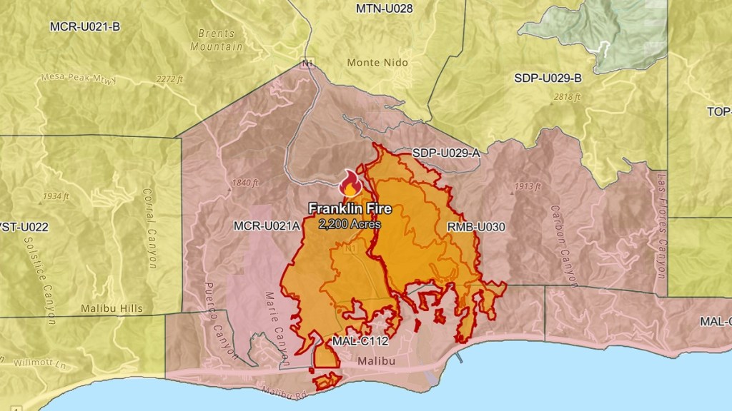
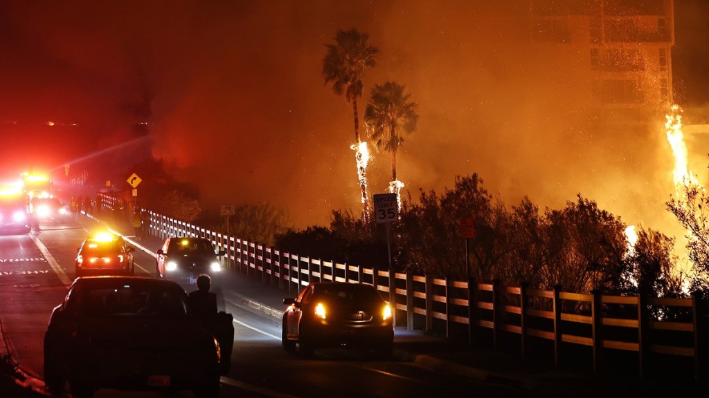
The Malibu fire map reveals how rapidly the Franklin wildfire has spread throughout southern California so far. The blaze has expanded to over 2,200 acres by 7 AM PT on Tuesday, December 10. This is only about eight hours after the start of the fire, which Cal Fire estimates to be at 10:50 PM PT on December 9. Mandatory evacuation orders are in place for many areas in the region. Here’s the map for the Malibu fire, officially known as the Franklin fire.
What is the Franklin fire map in Malibu?
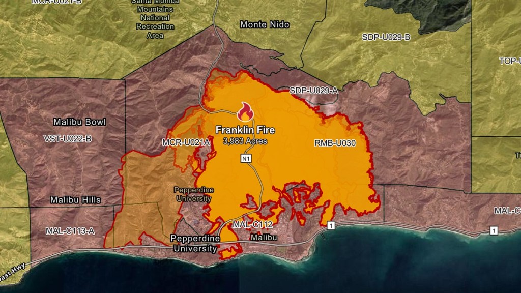
[Update – December 11, 2024, 7:50 AM PT] The Franklin fire has spread to 3,983 acres thus far. Over 1,500 firefighters have been assigned to contain the blaze, but strong winds and low humidity made conditions difficult. The latest status report still has the fire at 0% containment. For comparison, here’s the new Malibu fire map as of 8:00 AM PT.

[Original] The map for the Franklin fire is mainly concentrated in the Malibu Canyon area, cutting across Pepperdine University and stretching as south as the Pacific Coast Highway, as of 9:00 AM PT on December 10.

An incident update from Cal Fire at 8:27 AM PT reveals that the wildfire is still active and is at 0% containment. The exact cause of the Malibu fire is still “under investigation” by the Los Angeles County Fire Department.
The City of Malibu also provided a fire map in a post on X (formerly Twitter), providing the status of the wildfire and evacuation zones at 4:42 AM PT. For the latest fire map of the Franklin fire, you can head to this link from Genasys or go to the official page for the fire on Cal Fire.
The severity of the Malibu fire is due in part to strong Santa Ana winds, low humidity, and dry vegetation, according to a special report by the National Weather Service on Tuesday morning. The agency issued a rare red flag warning for Los Angeles, stating that “critical fire weather conditions are expected through at least Wednesday.” These Santa Ana winds were also partially responsible for the speed of the Mountain fire in Ventura County in early November.
Fortunately, the strength of the Santa Ana winds is forecast to diminish by Tuesday night and “a cooling trend with an increase in humidity” is expected on Thursday.


